Lure of Long Beach Island Restored Vintage Map
Lure of Long Beach Island Restored Vintage Map
$29.95
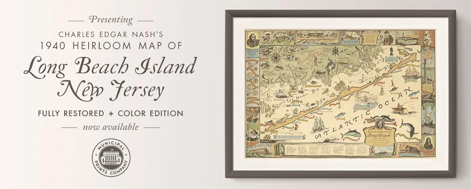
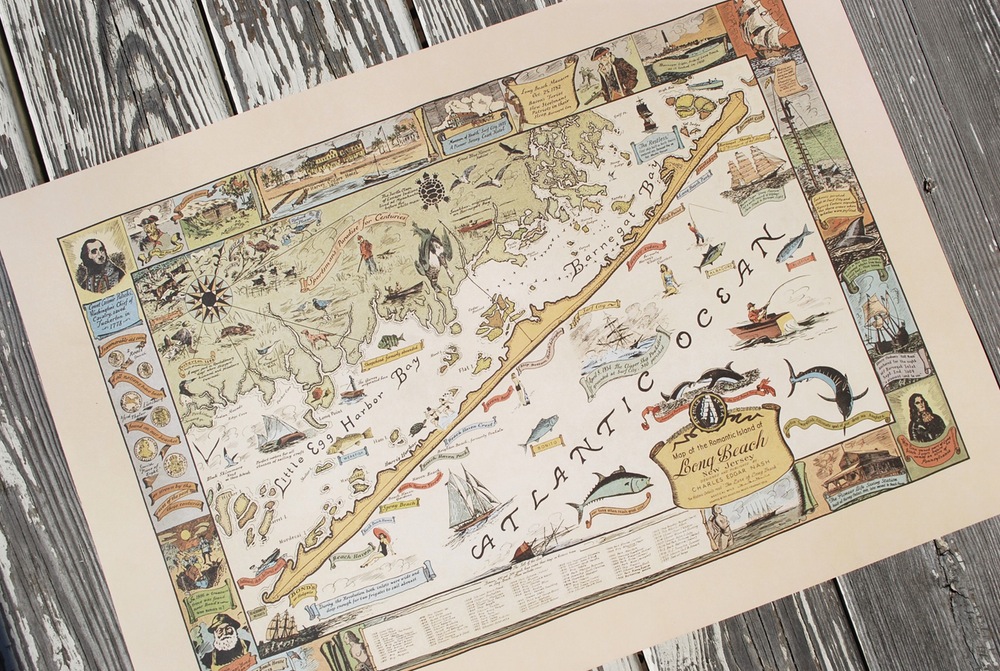
This new, fully restored legacy edition of Charles Edgar Nash's cherished map of Long Beach Island, New Jersey, is now available in full color in a special heirloom edition. First printed in 1940, the map features LBI's geography, insightful details of its early colonial history and a chronology of ships lost off LBI's waters in a charming vintage style. A must for every home on LBI, including ours, our base of operation over the summer months, two hours south of NYC.
Dimensions: 24.5 in x 17.5 in
Paper: Acid-free vellum cover stock
Frame: Unframed
Origin: Printed in the Garden State
Quantity: